In today’s rapidly evolving world, the construction and infrastructure projects demand innovative solutions to meet the increasing complexity and scale of projects. VTOL Media stands at the forefront of this technological revolution, offering a comprehensive suite of aerial services that leverage the power of Unmanned Aerial Vehicles (UAVs) to deliver unparalleled insights and efficiency.
Specialised Aerial Solutions
At the heart of our services lies our expertise in aerial cinematography and photogrammetry. Our team of skilled pilots and engineers employs state-of-the-art UAV technology equipped with high-resolution cameras and advanced sensors to capture detailed and accurate data. This data includes:
- 2D and 3D Models: Precise digital representations of the project site, providing a comprehensive overview of its topography, structures, and surrounding environment.
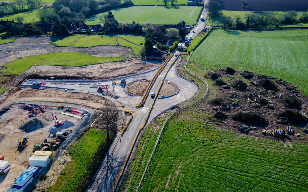
- High-Resolution Imagery: Detailed aerial photographs that capture every nuance of the infrastructure project, from construction progress to potential hazards.
- Progress Reporting: Time-lapse videos and aerial footage that document the infrastructure project’s evolution over time, offering stakeholders a visual timeline of development.
The Power of Photogrammetry
Photogrammetry, a sophisticated technique that extracts measurements and information from images, is a cornerstone of our services. By processing aerial imagery, we create highly accurate 3D models that provide invaluable insights for engineers, project managers, and other stakeholders. These models enable:
- Precise Measurements: Accurate determination of distances, areas, and volumes, ensuring that projects adhere to design specifications and budgets.
- Remote Assessments: Detailed inspections of structures and infrastructure without the need for on-site personnel, reducing risks and costs.
- Streamlined Decision-Making: Informed and timely decisions based on real-time data and analysis.
Progress Reporting: A Visual Journey
Our progress reports offer a unique perspective on project development. By combining aerial video and time-lapse photography, we create compelling visual narratives that showcase the project’s transformation over time. These reports are invaluable for:
- Stakeholder Engagement: Effective communication with investors, clients, and regulatory bodies through visually appealing presentations.
- Issue Identification: Early detection of potential problems or deviations from the project plan.
- Documentation: A comprehensive record of project progress and milestones.
Safety and Innovation: Our Core Values
Safety is paramount in all our operations. Our team of experienced pilots adheres to strict safety protocols and guidelines, ensuring that our UAV flights are conducted responsibly and without risk to personnel or property. Additionally, we continuously invest in the latest technology and training to stay at the forefront of the industry and deliver innovative solutions to our clients.
A Comprehensive Solution
VTOL Media offers a comprehensive suite of aerial services tailored to meet the specific needs of infrastructure projects. Whether you’re building a new road, constructing a bridge, or developing a large-scale urban development, our expertise can help you achieve your goals efficiently and effectively.
By partnering with VTOL Media, you can benefit from:
- Enhanced Efficiency: Reduced project timelines and costs through data-driven decision-making.
- Improved Safety: Minimized risks associated with on-site inspections and hazardous environments.
- Increased Accuracy: Precise measurements and data for informed planning and execution.
- Enhanced Communication: Effective stakeholder engagement through visually compelling progress reports.
Choose VTOL Media as your trusted partner for aerial solutions in the infrastructure industry. Our commitment to cutting-edge technology, safety, and innovation ensures that we deliver exceptional results that drive project success.

